

Sign up for our free weekly email weather newsletter, featuring weather journalist Kevin Myatt.
National Weather Service meteorologists have confirmed that a tornado struck Salem on Sunday, part of a widespread outbreak of wind damage as a thunderstorm complex with origins in the Plains states swept across much of Southwest and Southside Virginia on the evening before Memorial Day.
The tornado — captured on video as a thin funnel aloft and swirl of debris by eye surgeon Tyler Anderson from an elevated location to the north near the Salem VA Medical Center — traveled a 2-mile-long path up to 300 yards wide with maximum winds of 100 to 105 mph, according to the weather service, qualifying it as an EF-1 tornado on the 0 (weakest) to 5 (strongest) Enhanced Fujita Scale.

“The tornado touched down near the intersection of Karen Drive and Joan Circle, where tree trunks were snapped,” the weather service survey reported. “Additional trees were snapped and uprooted as the tornado moved east-northeastward, with loss of roofing material noted at several homes and apartment buildings just south of the Roanoke River. The tornado lifted just east of Electric Road near the intersection of Midland and Easton Roads.”
This track would have taken the tornado from a residential area of southwest Salem roughly along Apperson and East Riverside Drive before it lifted not far northeast of the intersection of Electric Road (Virginia 419) and U.S. 11 (Apperson Drive).

Cleanup begins after high winds
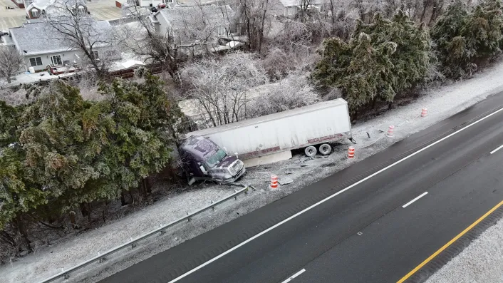
Meanwhile, by mid-afternoon on Memorial Day, statewide power outages, mainly in Southwest Virginia, had been reduced from over 60,000 customers on Sunday evening to just under 25,000, according to the utility data aggregator Poweroutage.us. Nearly 3,000 remained without power in Giles and Pulaski counties, with between 1,000 and 3,000 in Alleghany, Bedford, Roanoke and Tazewell counties.
“Appalachian Power has requested assistance from outside crews and contractors to assist with the more than 100,000 customers without power due to severe storms,” the utility said in a statement early Monday, reflecting a number that included outages in its service area in both West Virginia and Virginia at the time. The utility was estimating 90 percent of its customers without power would have electricity restored by 11 p.m. Tuesday.
One person was injured at Pearisburg when winds blew a tree onto a tent. Elsewhere, campers were rescued by Rockbridge County Fire and Rescue after trees fell on a cabin, two campers and two vehicles at Jellystone Park near Glasgow. Two adjacent commercial structures in western Roanoke suffered major roof damage in high winds. And hail fell so heavily in higher elevations of Grayson County that roads were entirely covered by hail and leaves knocked off trees.

Tornadic factors
The tornado that occurred in Salem on Sunday was not the classic supercell variety, typically forming in the southwest flank of a discrete thunderstorm with a rotating updraft. Rather, this tornado was more typical of those occurring with quasi-linear convective systems (QLCS), a fancy name for a type of squall line, embedded within the squall line near or just behind the initial outflow of the gust front that was responsible for most of the reported damage on Sunday.
QLCS tornadoes rarely have the duration or intensity of medium to strong supercell tornadoes, as there are limiting factors with surrounding rain and straight-surface winds quickly altering the environment needed to sustain a rotating updraft. Most end up being rated EF-0 or EF-1, the two lowest damage ratings on the 0 to 5 Enhanced Fujita Scale.
Some factors that promoted the occurrence of a tornado in Salem:
· Backing winds. Surface winds were out of the east to southeast as the squall line approached the Roanoke Valley. Surface winds opposite or at angle to storm motion can help promote spin at the lower levels of the atmosphere.
· Pre-existing discrete storm cells. Several isolated storm cells developed ahead of Sunday’s squall line, some of which may have developed broadly spiraling updrafts. As the squall line advanced, it absorbed the smaller cells, potentially ingesting the spiraling motion that could have enhanced a tornado updraft. Also, conflicting outflows between the smaller cells and the squall line could have enhanced spin.
· Horizontal convective rolls. National Weather Service Doppler radar was detecting these — horizontally spinning moist strips of air — in the hours before the squall line arrived. Numerous bands of these streaming northward as was detected on Sunday often precede larger severe storm outbreaks in the Central U.S. Air rotating horizontally as it warms in daytime heating can be stretched vertically by storm updrafts.

A tall tree snapped off shows the strength of winds reaching up to 105 mph along East Riverside Drive in Salem with an EF-1 tornado on Sunday. Courtesy of Doug Griggs. 
A large leafy tree was blown into the Roanoke River by an EF-1 tornado in Salem on Sunday. Courtesy of Doug Griggs. 
Metal roof material was blown up against a bank building along Colorado Street in Salem on Sunday. Photo by Dutchie M. Jessee 
Tree debris fills a front yard along East Riverside Drive in Salem after an EF-1 tornado on Sunday. Courtesy of Doug Griggs.
Salem tornado history
This was not the first tornado to hit Salem.
Salem last experienced a confirmed tornado near sunrise on April 4, 1974. That tornado, which began at the corner of Lynchburg Turnpike and Electric Road in Salem, traveled northeast with an intermittent path of damage across northern Salem, the western and northern sections of the city of Roanoke and into Roanoke County as far as Bonsack, injuring five people and causing what today would be almost $4 million in damage. Four schools and two apartment complexes were damaged in the tornado, which would be far more destructive along a similar path today with heavy commercial buildup where cows used to graze in the Valley View Mall area. That tornado was the 126th of 148 confirmed tornadoes in the April 3-4, 1974, Super Outbreak that killed 315 people in the eastern half of the U.S. and southeastern Canada.
Salem also suffered what historical weather researcher Tom Grazulis has identified as a tornado on April 24, 1896, killing three people and demolishing at least two structures along Colorado Street.

The Roanoke Valley last experienced a tornado on June 3, 2008, when an EF-0 tornado skipped across South Roanoke from near Virginia Western Community College to the lower flanks of Mill Mountain in the Robin Hood Road area, causing what today would be about a half-million dollars of damage on 55 properties, mostly from fallen trees. Although that tornado had winds no higher than 80 mph and a path no wider than 60 yards, the thin funnel was highly visible and seen by many Roanoke Valley residents.
This is the second tornado that has been confirmed in Cardinal News’ coverage area of Southwest and Southside area so far in 2024. On April 11, an EF-1 tornado similar to what occurred in Salem cut a mile-long, 250-yard-wide path with 100-107 mph winds just south of Swansonville in Pittsylvania County, with damage confined to trees.
See also: “Why Virginia isn’t a tornado alley.”

Weather ahead
There was still some potential for thunderstorms to develop, a few of which could be severe, across the central and eastern parts of Virginia late Monday.
Beyond that, a cold front will sweep in much cooler and drier weather for the remainder of the week, with 40s and 50s lows and 60s and 70s highs most days, perhaps some low 80s on Tuesday and again on Friday.
After Monday, no further rain or thunderstorms are expected through at least Sunday.
Journalist Kevin Myatt has been writing about weather for 20 years. His weekly column, appearing on Wednesdays, is sponsored by Oakey’s, a family-run, locally owned funeral home with locations throughout the Roanoke Valley.
