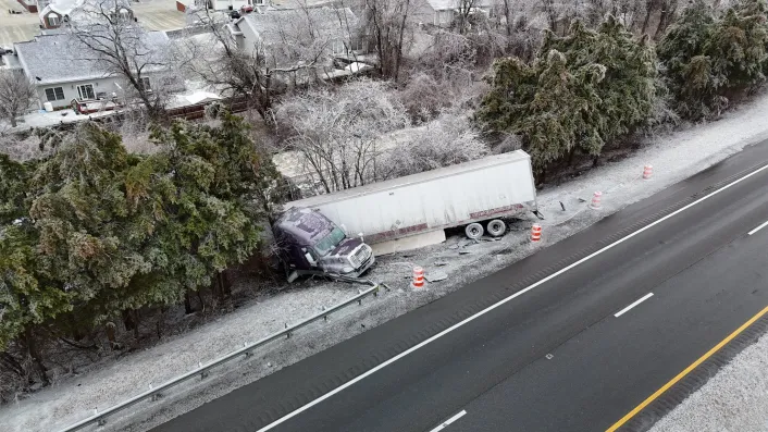


White ribbons of snow laced every limb throughout Friday outside my window and those of many others in Virginia. It was a beautiful holiday season scene, if a troublesome one for many.
Still almost three weeks before Christmas, and coming after several winters when snow has been infrequent, one could only wonder when such a sight would be seen again.
The answer: The following Monday.

Within four days, on Dec. 5 and 8, two similar snowfalls have blanketed a large section of Virginia, including most — but not quite all — of the Cardinal News coverage area of Southwest and Southside Virginia.
In each case, there were many reports of 2-5 inches of snow, a few a little more, some a little less, and as noted, a few spots missing. For many locations, it is already the most snow that has fallen in December since 2018, when a widespread foot-plus snowstorm was just finishing up on this Dec. 10 date.
We might not be done with snow this week.

More snow?
There are at least two potential rounds of additional snow in the next 48 hours for parts of Virginia.
The first is a very typical winter event, northwest-flow, upslope-enhanced snow squalls focused on the mountains along the state’s western fringe and Southwest corner overnight on this Wednesday into early Thursday. A strong cold front pushing through on this Wednesday is turning winds to the northwest and usher in another round of cold air, and the lift over the mountains will produce snow squalls and showers as those cold winds glide over the Appalachians in West Virginia and far western Virginia.

Gusty winds and snow — falling and blowing — are expected to be brutal enough for an infrequent blizzard warning to be issued in some of eastern West Virginia’s high elevations. Sufficient snow for some accumulation will likely reach areas west of Interstate 77 in Virginia and also the mountains rimming the state’s western fringe, with some streaky 1-3-inch amounts. If you have lived in these areas for long, you know whether your town or home location often gets in on these northwest-wind snow squalls.
Weaker snow showers and flurries may blow eastward to the New River Valley, I-81 corridor, and Blue Ridge north and south of Roanoke, perhaps a few flakes making it into the Roanoke Valley or even a little east of the Blue Ridge. This might have been a bigger pre-Christmas “taste of winter” deal if much of this area hadn’t just had two significant snowfalls in four days.
Then, on Friday, there is an Alberta clipper system diving southeast, generally toward Virginia. A lot is uncertain about the track of this system, but it may again bring snow to a large part of Virginia, most likely in the western and northern parts. Accumulations are not expected to be large, probably lighter than the previous two storms, and there is still much uncertainty about the track of the storm. We’ll follow up here on Thursday night if a fair-sized chunk of Cardinal Weather’s Southwest and Southside Virginia coverage area looks to be on track for at least a couple more inches.

Twice as nice … or twice the pain?
It has seemingly been difficult enough to line up snow that covers a lot of real estate in the commonwealth over many recent winters, but to get two in four days before we even get 10 days deep in December seems quite bizarre.
It has been 20 years since Blacksburg, Roanoke and Wytheville had two snowfalls of at least an inch within the first 10 days of December. Those were small snows around 1-2 inches on Dec. 6 and Dec. 9, 2005, and truthfully, the second one was mostly sleet, which gets counted as “snowfall” in official weather records. Before that, you have to go back to 1996 at Blacksburg, 1942 at Wytheville, and never in recorded weather data going back to its start in 1912 at Roanoke. Lynchburg appears to have had one previous case of getting at least an inch of snow twice in the first 10 days of December, in 1959.

Getting two snows of at least 2 inches before Christmas hasn’t happened in 36 years at Roanoke and Lynchburg, last occurring in 1989, and hasn’t happened in 15 years at Blacksburg and Wytheville, last in 2010. Each of those four locations have gotten 2-4 inches of snow on both Dec. 5 and Dec. 8 in 2025.
You may have seen excited online chatter around Thanksgiving about a developing hard winter pattern for December. Well, the factors going into that didn’t fully manifest, but did to a large enough extent that colder than normal temperatures have settled into much of the Eastern U.S. and the northern branch of the jet stream has delivered upper-air disturbances pretty far south. It’s been sort of a Goldilocks-zone for Virginia snowfall, not so cold as to press the storm track too far south and leaving it dry here, and not so far north that too much mild and wet air has moved north with passing systems for a lot of cold rain and nasty mix.

That pattern is set to deliver a couple more shots of Arctic air late this week and early next week, with some possibility for additional snow, as discussed above. There are signals of a possible almost-nationwide warmup toward mid-month, maybe even as late as Christmas.
Some of these warmup periods in the long range have already turned into mirages, and we don’t have much idea what would lie beyond such a mid-December thaw if it is realized. But those who don’t like snow should cling to some hope for your version of holiday cheer.

Those who didn’t get snow
The southern fringe of Virginia’s southwest corner, from the Bristol area west to the southwest tip in Lee County, has largely missed out on substantial snow both Friday and Monday. A few inches of snow has been a short distance to the north or a little higher in elevation, but this narrow strip has been a little too far south relative to the storm’s track for most of the snow and too far west to be in the “cold-air wedge” that develops generally along and east of the spine of the Appalachians.
A small semicircle around Danville largely missed out on Friday’s snow, getting minor accumulations after a slow changeover from rain and temperatures hovering just above 32 degrees. But Monday’s snow was a little more generous, though also marginal, as Danville went from recording 0.5 inch of snow that melted quickly on Friday to 1.8 inches on Monday.
Northern Virginia along and north of Interstate 66 got light amounts in Friday’s snow and then got entirely zilched by Monday’s storm. The coverage of Monday’s storm across Virginia was very reminiscent of what happened seven years ago this week on Dec. 9-10, 2018, when much of the southern half of Virginia got 1-2 feet but the snow area petered out before it got to the D.C. area. (Insert jokes about hot air from Washington politicians deflecting snow away here.)

And then were some localized weirdnesses, like Gabe Caldwell told me about at Eggleston, along the New River at Giles County. While many locations around were getting inches of snow on Friday, his spot had a dusting early in the morning that melted, then the rest of the day’s snow was “white rain” as it was too warm to stick. My guess is that the thin lower-atmosphere warm layer that led to early rain on Monday morning at several locations in western Virginia got pushed into the New River Valley by the cold air wedge moving in from the northeast, disrupting snow accumulation (other relatively small amounts were reported very near the river as well).
A dozen years ago, a mid-January snowstorm that dumped 3-6 inches on much of our region left odd “snow holes” a few miles across just east of the Blue Ridge. One of these was at Callaway in western Franklin County. On Friday, Callaway had the highest snowfall report turned into the National Weather Service office at Blacksburg, with 5.8 inches. Give it enough time and even the localized weather quirks even themselves out.

What does it mean for the rest of winter?
The short answer is that getting a couple of snows early in December means very little about how the rest of winter will go.
Some will be hoping that we are getting winter out of the way and there won’t be much more to deal with once the calendar actually says winter. Some years previously mentioned, like 1989 and 2018, were largely that way. It is often the case that a big Arctic surge early in winter pours itself out and doesn’t really recharge or rebound much later in the season.
But early wintry weather could also be symptomatic of recurring atmospheric patterns that have been occurring since last winter and may be set to repeat this winter as well, leading to a winter of frequent cold air pushes and occasional to frequent wintry precipitation chances. This has been my thought about the winter, as expressed in a previous Cardinal Weather column.
Only time will tell. But getting two snows so early does, at the least, leave a lot of time for more to happen, and has already buried a few of the lowest-end entries in the Cardinal Weather snowfall prediction contest.
Journalist Kevin Myatt has been writing about weather for 20 years. His weekly column, appearing on Wednesdays, is sponsored by Oakey’s, a family-run, locally-owned funeral home with locations throughout the Roanoke Valley.
To submit a photo, send it to weather@cardinalnews.org or tweet it to @CardinalNewsVa or @KevinMyattWx. Please identify the location and date of the photo with each submission.
Sign up for his weekly newsletter: