

You can share your weather photos at weather@cardinalnews.org. Please include your name along with where and when the photo was taken.
See our update on power outages.
Virginia’s most widespread winter storm in three years will continue into Monday with snow in the northern half of the state and a wintry mix of freezing rain, sleet, snow and some plain old cold rain in the southern half of the state.
Sunday afternoon brought a band of snow across Southwest and Southside Virginia that proved a little earlier and heavier than anticipated for many, with 1-5 inches common across much of Cardinal News’ readership area. For some areas of Southside such as Martinsville and Danville, it was the first measurable snowfall since March 12, 2023.
Snow was continuing Sunday evening north of the U.S. 460 corridor, with a changeover to sleet and freezing rain moving northeastward, having just passed the Roanoke Valley by mid-evening.
Overnight, additional sleet and freezing rain was expected, with snow in the areas south of Interstate 64 eventually becoming mixed with or changing to sleet and freezing rain. Snow was expected to continue overnight in the northern half of Virginia with many locations north of Interstate 64 topping 6 inches, and perhaps a few spots reaching a foot.
Ice projected to accrete 0.1 to 0.4 inch in Southwest and Southside Virginia atop previous snow and sleet poses the risk of scattered power outages by Monday morning. While Virginia had few power outages Sunday evening, Kentucky, Illinois and Missouri, affected by the same winter storm, combined for about 100,000 utility customers without power by mid-evening Sunday, according to data aggregator poweroutage.us, with that precipitation headed eastward toward Virginia.
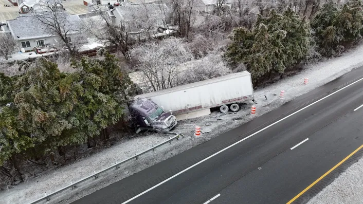
Treacherous roads were reported in many parts of Virginia, expected to continue with only slow improvement on Monday.

Monday will bring a gradual lessening of wintry precipitation from west to east across the state, with some areas in the southern half of Virginia poking above the freezing mark.
By late afternoon and evening, some bands of snow may redevelop over central and western Virginia as the low-pressure system responsible for the winter storm departs offshore, pulling colder air behind it. Additional amounts are expected to be light, and it is somewhat uncertain where the most significant snowfall might occur late Monday.
Any remaining snow or ice accumulation from this winter storm is likely to remain on the ground for many days, as windy, cold blasts of Arctic air will drop lows into the teens and even some single digits much of the week, with highs likely no higher than the 30s over most of Virginia through the coming weekend.
Friday and Saturday may bring another chance of snow or wintry precipitation to Virginia as a low-pressure system tracks across the South, but details of that will have to be discerned in days ahead.

Journalist Kevin Myatt has been writing about weather for 20 years. His weekly column, appearing on Wednesdays, is sponsored by Oakey’s, a family-run, locally-owned funeral home with locations throughout the Roanoke Valley. Sign up for his weekly newsletter: