

Want to be the first to see weather news? Sign up for our weekly email weather newsletter, featuring weather journalist Kevin Myatt.
Tornadoes usually seem like someone else’s problem here in Southwest and Southside Virginia.
Most of the time, it’s like last Friday, when we see horrifying images from distant places to our west like Wynne, Arkansas, and Coralville, Iowa.
(I covered high school games once upon a time on that football field rolled up like a cheap carpet at Wynne, and I’ve stayed in a hotel multiple times at Coralville on the way to chasing storms in the Plains with Virginia Tech meteorology students, so those hit me a little more than they did most of you.)
Even in those infrequent times when tornadoes cut paths of destruction through parts of our region, to anyone outside those narrow paths of destruction, it’s someone else’s problem.
And this is the inherent problem in communicating about severe weather.
When we get a snowstorm (think back to before this alleged winter), everyone for many miles around is affected. You may not be stuck in a drift on the interstate, but it’s something to trod through or shovel off the driveway or get your school day called off for.
When we get a heat wave, maybe the thermometer outside your house doesn’t hit triple-digits, but it’s pretty uncomfortable, and potentially life-threatening with exertion, for everyone for many miles around.
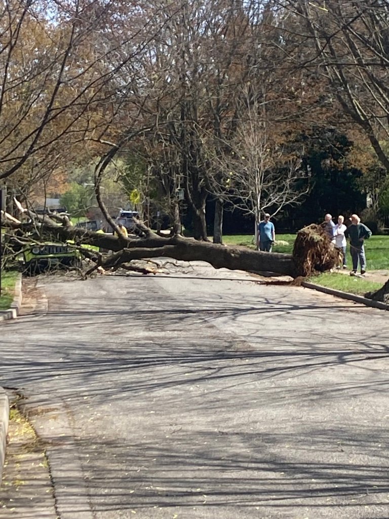
Severe thunderstorms are usually not like that. Somebody gets a tree blown down, somebody else gets a hail-dented car, someone may even get something spun around in a twister. But 25 miles away, 10 miles away, even a few blocks away, it was just a few rumbles of thunder and something some people think those weatherpeople on TV shouldn’t have interrupted their sports event or favorite show to squawk about.
So let’s talk today about informed and reasonable expectations for severe storms forecasts, watches and warnings as issued by the Storm Prediction Center (SPC), the National Oceanic and Atmospheric Administration’s central agency for analyzing and communicating severe thunderstorm and tornado potential, and your local National Weather Service offices.

It is relevant and pertinent. Some of Virginia’s westernmost counties are in a “marginal risk” of severe storms overnight Wednesday into early Thursday morning. Then, much more of the state is in “marginal risk” on Thursday.

So why do we care if the risk is only marginal that there will be any severe storms in the area?
Well, a marginal risk doesn’t actually mean that. It is all geared to the likelihood of a storm possessing severe attributes within 25 miles of a given point, not within the entirety of the designated area.
A marginal risk means there probably will be a place or two or a few that get winds gusting 58 mph or greater, hail 1 inch or greater or perhaps even a tornado somewhere in the entire delineated zone. But the chances of that happening within 25 miles of a given point – your house – are about 5% for damaging winds or large hail, and about 2% for a tornado.
Let’s be clear: Those are the only three things considered to be severe attributes of a thunderstorm. Frequent lightning does not make a storm severe. Neither does excessive rainfall. There are other forecast products that focus on those risks, which can be extremely deadly. But “severe” in reference to thunderstorms refers to damaging winds, large hail and tornadoes. That’s it.
A slight risk is a notch higher than marginal. Again, that doesn’t mean there is only a slight risk of a severe storm forming somewhere within the yellow shaded area on SPC outlook maps, it just means there’s not a big chance one will occur within 25 miles of your house. But the chances go up to 5% for tornadoes and 15% for high wind and large hail, within 25 miles of any given point, with a slight risk.
Beyond that are “enhanced” (10-15% for tornadoes, 30-45% for wind and hail), “moderate” (15-30% for tornadoes, 45-60% for wind, 45+ % for hail) and “high” (30-60% for tornadoes, 60+% for wind). These don’t get issued very often for our region – pay attention if they ever do.
Even if a high risk for a tornado verifies, it may still happen 25 miles from your house. But that’s getting too close for comfort.
For simplicity, these percentages only refer to the Day 1 maps, which is whatever is issued for today, not the probabilities for Day 2 and Day 3 maps, covering tomorrow and the next day. You can review all those risk percentages on the Storm Prediction Center’s web page linked here.
Essentially, the SPC risks are more about coverage than about intensity or pinpointing a precise location that will be affected. (A “hatched” risk area can be issued when there is a particularly high threat of 75 mph winds, 2-inch hail or tornadoes of at least EF-2 strength.)
When it gets to within a few hours of storm time, watches and warnings become the more important vehicles for communicating risks to the public.
Watches mean conditions are favorable for tornadoes and/or severe thunderstorms to develop. It means just what it says – be on the watch for possible severe storms by staying tuned to dependable media or social media (National Weather Service handles and pages are always recommended) for future statements or possible warnings. Also, watch outside for what appear to be threatening skies or conditions developing and get inside if you sense it is getting dangerous.
Warnings are issued by local National Weather Service offices for specific storm cells, naming localities within a polygon that are likely to be affected. Even this does not mean every square inch of the localities named will see damaging winds, large hail or experience a tornado, but a storm capable of producing one or more of those conditions has been observed by spotters or radar and precautions should be taken promptly to protect the lives of you and those around you from the storm threat. (Get inside, away from windows, on the lowest floor, generally. Get as low as possible and cover your head if there is a tornado warning.)
So that is how we get from broad risk zones issued over wide geographic areas to specific warnings that might include your house.
For this specific storm chance, as with much of winter, the strongest storm dynamics are tracking well north and west of our region, but a cold front pressing into warmth and moisture might be enough to trigger some strong to severe storms.
Late Wednesday night and early Thursday, a storm or two with gusty winds might make it into the western fringe of the state from the Ohio Valley. On Thursday, more storms may form near or just east of the mountains and track eastward toward the coast.
There is no reason to panic with any severe storms risk. The chances are always low that your exact spot will get the worst weather imaginable. But it’s always a good idea to be prepared for the worst and ready to take action accordingly, because sometimes, it isn’t someone else’s problem.
Weekend’s howling winds
As was expected and thoroughly forecast with high wind warnings and wind advisories, gusty winds ripped over much of Southwest and Southside Virginia on Saturday behind a cold front and within the pressure gradient of deep low pressure to the north and high pressure to the west.
At the peak, nearly 100,000 customers of various utilities were without power in Virginia late Saturday night, and there were many reports of trees and limbs being blown down. Several wildfires were sparked by downed power lines and/or spread by the winds through relatively dry surface fuels.
Here is a list of reported peak wind gusts around our region that reached or exceeded 50 mph:
50 mph, Woodlawn, Carroll County
51 mph, Burkes Garden, Tazewell County
51 mph, Galax
51 mph, Hardy, Franklin County
51 mph, Mountain Empire Airport, Smyth County
51 mph, Tazewell County Airport
52 mph, Ingalls Field Airport, Bath County
53 mph, 0.9 mile south of Blacksburg, Montgomery County
54 mph, Twin County Airport, Carroll County
56 mph, Bald Knob near Mountain Lake, Giles County
56 mph, Willis, Floyd County
59 mph, Bent Mountain, Roanoke County
59 mph, 3.6 miles NE of Floyd, Floyd County
60 mph, Roanoke-Blacksburg Regional Airport, Roanoke city
61 mph, Tri-Cities Airport, Tennessee (serves Bristol area)
63 mph, 3 miles NE of Crockett, Wythe County
65 mph, Grayson Highlands State Park, Grayson County

Snowfall contest results coming soon
The 2022-23 snowfall forecast contest has ended. Yes, even with almost no snow, there was a clear winner who predicted exactly that for two of the six sites within the region. There were also several entries that deserved mention for some element of the prediction being correct or pretty close.
I hope to be able to announce the outcomes next week (could be later if there is more pressing weather to deal with next week).
It is my plan to develop a summer-related weather contest we will discuss in this space next month.
Journalist Kevin Myatt has been writing about weather for 19 years. His weekly column is sponsored by Oakey’s, a family-run, locally-owned funeral home with locations throughout the Roanoke Valley.
