

Want to be the first to see weather news? Sign up for our weekly email weather newsletter, featuring weather journalist Kevin Myatt.
So, finally, it snowed – widely, but not deeply.
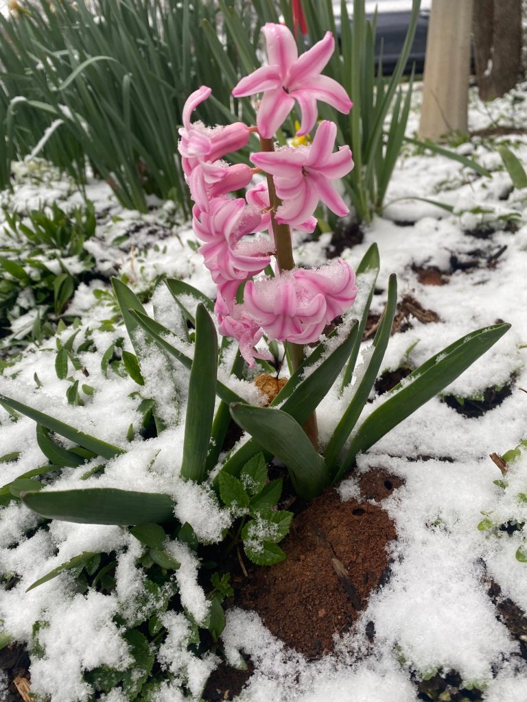
It was just enough snow to be conversational for many and inspirational for some without being overly obstructive. Snow added ivory touches to colorful flower beds and prematurely blooming fruit trees aroused from hibernation by the warmest January-February period on record in many parts of our region. Roadways still holding some of that warmth melted most of what fell before it could cause travel problems.

Nowhere was it the deepest snow that Cardinal News territory has seen in 2022-23 winter, apparently staying within projected trace to 2-inch bounds. But it was by far the largest areal coverage of snowfall of the season across Southwest and Southside Virginia, leaving out only some areas west of Interstate 77 that had already had a couple of rounds of snow with as much as 5 inches earlier in the winter.
Snow spread from near the Interstate 77 corridor in the west before dawn Sunday, eastward across the New River Valley, Blue Ridge and Roanoke Valley near and shortly after sunrise, then across the Piedmont and Southside in the mid to late morning.

The snow was caused by a low-pressure system spreading moisture from the west into wedged cold air banked against the mountains. This same low will spin up into a nor’easter that will finally dump deep snow in New England, which has also had much less than normal this season.
What was a rainstorm in Kentucky and Tennessee – and the southwest corner of Virginia – encountered deeper cold air as it moved eastward, allowing precipitation to reach the surface as snow.
Milder air aloft chased the snow, turning it to a wintry mix of sleet, freezing rain, rain and occasional random snowflakes in the same west-to-east progression as the morning’s snowfall.
But that did allow for two or three hours of snowfall in many places that have seen very little or none of it previously in the 2022-23 winter season.
· Roanoke, with 0.4 inch, avoided having its first winter without snow accumulation since 1920. Also, Sunday’s snow ended a streak of exactly one year, going back to March 12 of last year, with no measurable snow.
· Danville, with 0.5 inch, avoided having its first winter without snow accumulation since 1998.
· Blacksburg tallied 0.4 inch to move its season total over an inch, to 1.3 inches, still on track to be the least snowy cold season (late fall to early spring) on record going back to the late 1890s if there is not another inch of snow in days ahead.
· Lynchburg totaled 0.2 inch to move it to 0.5 inch total for the season, still on track without almost an inch of additional snow to be the second least snowy winter since 1893, trailing only the trace-snow winter just three years ago in 2019-20.

In reports around the region to the National Weather Service, Mountain Grove in Bath County had 1.6 inches, Stewartsville in Bedford County 1.3 inches and Spring Valley in Grayson County an inch for some of the larger amounts. Rocky Mount in Franklin County, Cave Spring in Roanoke County and Meadows of Dan in Patrick County each measured almost an inch at 0.8, with lesser amounts over most of the rest of the region.
It is likely some higher elevations above 3,000 feet received more snow, and possible there were other locations between these sites that may have gotten as much as 2 inches in heavier bands.
Winter is not about to let go of its late grip on our region. Northwest winds behind a new cold front may bring mountain snow showers to western areas Monday and Tuesday, with a likely areawide hard freeze on Wednesday morning. Widespread lows in the 20s with some teens west of the Blue Ridge will likely cause freeze damage to many bloomed and budded plants.
Temperatures recover late in the week with a couple of days in the 60s, but a weekend cold front renews the ongoing winterlike pattern with some cold days next week.
There is no guarantee that Sunday’s brush with snow was the last one for 2022-23 in our region.
Journalist Kevin Myatt has been writing about weather for 19 years. His weekly column is sponsored by Oakey’s, a family-run, locally-owned funeral home with locations throughout the Roanoke Valley.
