Want to be the first to see weather news? Sign up for our weekly email weather newsletter, featuring weather journalist Kevin Myatt.
The 80s this week aren’t about big hair, MTV or Ronald Reagan.
The 80s are where the mercury could climb for roughly half our region on Thursday, more like temperatures that are typical for mid-June, not the 23rd day of February.
Record high temperatures for Feb. 23 of 69 at Blacksburg (1980), 74 at Danville (1943), 74 at Lynchburg (1943) and 76 at Roanoke (1943) appear nearly certain to be eclipsed, quite likely by 4-8 degrees, with all but the highest elevations expected to reach at least the mid 70s across almost all of Southwest and Southside Virginia.
Most of the region east of the Blue Ridge plus the Roanoke Valley and maybe even a few lower spots to the west have a good shot to reach or exceed 80 degrees, especially Southside, where some locations near the North Carolina line might reach the mid or even upper 80s. There is a realistic chance that a location or two in the Carolinas might touch 90 – in February, mind you.

If it makes 80 – early clouds and spotty sprinkles have at least some chance of keeping that bar from being reached in some spots – it would be Lynchburg’s fifth time on record to reach 80 in February, Roanoke’s sixth time, Danville’s 14th time and, if it gets warmer than expected, Blacksburg’s second time, each site being a major climate station with over 100 years of records. (Roanoke also has had three 80-degree days in January, Lynchburg and Danville one each, all in the 1930s.)
· See the last section of this column for a listing of several regional locations’ all-time record highs for February, some of which could be challenged or surpassed on Thursday.
But you’re out of luck if you want that same kind of weather for your weekend.
By Saturday, high pressure to the north will bank cold air against the mountains as moisture overruns it. This will cause a raw, showery day with temperature stuck in the 30s and 40s. Some spotty icing in higher elevations – a 2022-23 winter trademark – is not out of the question.
Sunday will be dry and milder, but not 80. Most days ahead will be 50s and 60s highs, 30s and 40s lows, to close out February and begin March – above normal, but not ridiculously so.

What’s causing the warm spurt?
Warm air will be swept in on gusty southwest winds on Thursday, aided further in warming by compressing and drying as the winds head down the mountain slopes into lower terrain. (Beware some fire danger.)
The winds will be circulating around strong low pressure near the Great Lakes that, while raising our temperatures to record levels, may be dumping record amounts of snow on parts of Minnesota. Such are the fortunes of a late winter powerhouse storm system.
The continued southeast U.S. high-pressure ridge, a common feature of a La Niña (colder than normal equatorial Pacific sea surface temperatures) that has persisted for three years but is likely in its waning weeks, contributes strongly to the mild temperatures of this January and February, the lack of snow, and specifically to this summerlike surge.
Many atmospheric scientists would also suggest climate change likely makes it a little easier to poke above 80 in a February warm spell, although it’s difficult to attribute global climate effects too directly for any single-day regional event.
Seasonal and annual averages shifting decimals over decades define climate more than short-term events, however extreme. (We’ll get back to where this winter ranks in warmth, and recent trends compared to historical data, after meteorological winter ends Feb. 28. It will rank among the warmest on record in our region, but not the top warmest.)
A cold front passing through early Friday will end the warm surge, with lows dropping into the 30s by Saturday morning.

80s in February 5 years ago … snow in March
If Thursday’s warmth surge had come a day earlier, it would have a bit harder time setting daily records.
The last time we saw 80s in wintertime in our region was five years ago this Wednesday – Feb. 22, 2018 – when Roanoke soared to its all-time hottest winter temperature of 84 degrees, and Blacksburg achieved its only 80-degree wintertime temperature on record. (You’ll see many 2018s in the list of February records at the end of this article.)
The “rest of the story” on the February 2018 heat surge was not only that it didn’t last, but it didn’t portend any kind of early spring. Rather, it was followed by a tardy winter that had a hard time giving up.
March 2018 was colder on average than February was across most of our region, and there were widespread snowfalls over significant sections of Southwest and/or Southside Virginia on March 11, March 20-21 and March 24-25.
The March 24-25, 2018, snowfall was especially heavy, 5-18 inches, in the New River Valley and along the Blue Ridge south of Roanoke, even into western parts of Southside around Martinsville, where NASCAR delayed a Cup race because of snow for the first time in 25 years. Blacksburg got decimals short of a foot in that storm, and over 20 inches for the month, its second snowiest March on record, following barely a month after its hottest winter temperature.
And that brings us to now, whether this late February warmth surge will again be the harbinger of a cold March.

March winter madness? Not a slam dunk
One piece is moving into place that could bring about a late-arriving cold period in March.
High pressure is set to build back over Greenland, triggering the negative phase of the North Atlantic Oscillation, something we haven’t seen since December. This would tend to buckle the jet stream southward into the U.S., allowing for the potential dislocation of colder air masses southward.
But another piece of the puzzle isn’t cooperating, at least yet. A persistent PNA- (Pacific-North America pattern, negative phase) over the western U.S. is parking a trough of low pressure generally over that region, which in turn induces a high pressure ridge over the eastern U.S.
This tends to focus cold and snow over the West, with the jet stream lifting northward over the high across the northern tier of states.
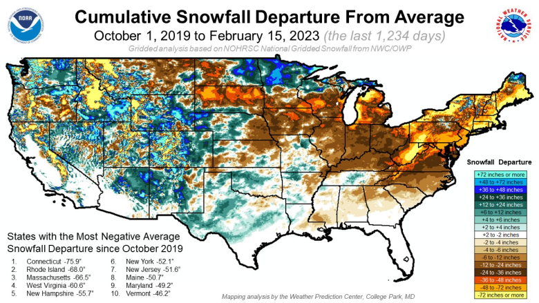
The high pressure over the southeast U.S. has a been a persistent feature of this mild, nearly snowless winter in our region, as it was in similar winters such as 1918-19, 1931-32, 1975-76, 2011-12 and 2019-20, deflecting cold air masses and potential winter storms away from our region.
Having these two factors conflicting with each other will probably ensure, at the least, that we don’t have a runaway early spring with frequent warm days like Thursday. Rather, we’ll probably get quick bursts of cold air followed by equally quick warmups through at least the first week of March, temperatures averaging above normal.
Moving out toward the second and third weeks of March, there are some long-range models indicating unseasonably cold air flooding much of the nation east of the Rockies, but it’s too far out to put much stock in that yet, especially if the PNA- pattern and southeast ridge remain stubborn.
Mid to late March snow events have not been all that rare since 2000, so having one or more to break the shutout or near-shutout most of our region has in snowfall would not be shocking except to our prematurely spring-tuned senses.
Whether or not a full-on cold pattern or any snow develops in March, historic averages alone tell us there are almost certainly cold nights and a few hard freezes ahead.
That will not bode well for anything that is budding, blooming or greening early in this preposterously warm late February. Gardeners beware!
There is almost always a check that comes due for out-of-season weather. How we pay remains to be seen.

Hottest February temperatures
Listed below are all-time record highs for the entire month of February across the region for a sampling of sites in Southwest and Southside Virginia with at least 30 years of data that are continuing to report in 2023.
· Abingdon, 79, 1977
· Appomattox, 80, 2000
· Bedford, 79, 1985
· Blacksburg, 80, 2018
· Bluefield, W.Va., 75, 1977
· Burkes Garden, 72, 1977 and 2018
· Covington, 79, 1977, 1985, 2000 and 2018
· Danville, 85, 1977
· Gathright Dam, 80, 2018
· Hot Springs, 77, 2018
· Lexington, 84, 1932
· Lynchburg, 82, 1932
· Martinsville, 82, 1977 and 2017
· Pulaski, 79, 1977 and 2018
· Richlands, 77, 2018
· Roanoke, 84, 2018
· Rocky Mount, 81, 1930
· South Boston, 83, 2017
· Pearisburg, 80, 2018
· Stuart, 82, 1930
· Tri-Cities Airport TN (Bristol area), 82, 1932
· Wise, 75, 2018
· Wytheville, 77, 1977 and 2018
Journalist Kevin Myatt has been writing about weather for 19 years. His weekly column is sponsored by Oakey’s, a family-run, locally-owned funeral home with locations throughout the Roanoke Valley.


